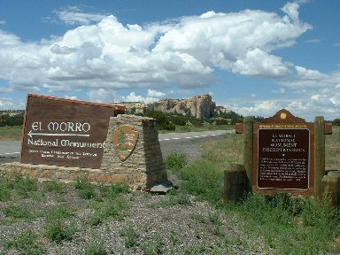
Above - The entrance signs for El Morro National Monument Inscription Rock. This is high mesa grassland at elev. 7100+ ft. The top of bluff rises to over 7700 ft.
Below - .
|
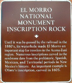
Above - The historic marker
Below - |
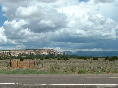
Above - More El Moro pics to come.
Below - |
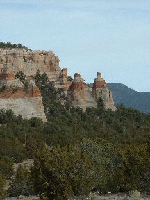
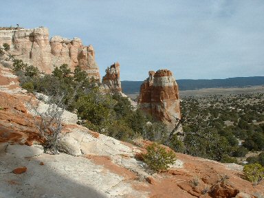
Above
- Los Gigantes, the giants, the sandstone spires at the end of the mesa in the center of the picture. In the distance is the Oso Ridge (elevation 8600 ft) of the Zuni Mountains. Los Gigantes can be viewed from NM Highway 53 on the way to Ramah. "Oso" is Spanish for bear and there are lots of black bear in the Zuni mountains. A bear is occassionally seen foraging for food on Black Sheep Mesa.
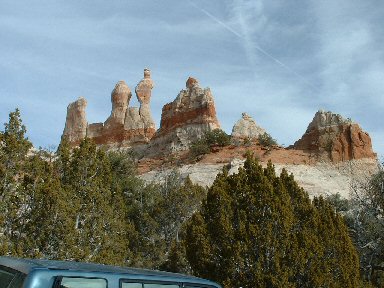
Below - Another view of the fantastic formations sculpted by the wind and rain into the bluffs of Los Gigantes. |
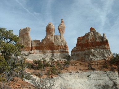
Above - A closer view of Los Gigantes can be accessed only with permission of the Ramah Navajo.
Below
- Note the cream, pink and redish brown sandstone which is characteristic of this area. |
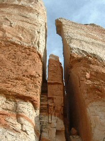
Above - Another view of the fantastic formations sculpted by the wind and rain into the bluffs of Los Gigantes.
Below
- A great view of the pinyon-juniper dotted grasslands of this "Upper Sonoran Life Zone". The Oso ridge of the Zuni mountains can be seen in the distance. |